Block/delete user/ad
|
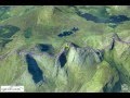
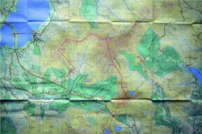
Training for Maamturks Challenge Week 2- Ballinagee Bridge - Silsean - Moanbane - Mullaghcleevaun - barnacullian - Stoney Top - Tonelagee - Wicklow GapWicklow
| Location: | Wicklow |
| Date posted: |
2014-01-20 12:13 | |
18/01/2014 Training for Maamturks Challenge Week 2- Ballinagee Bridge - Silsean - Moanbane - Mullaghcleevaun - barnacullian - Stoney Top - Tonelagee - Wicklow Gap
Meeting place: Wicklow Gap
Start: 8.45am
Distance: 22km
Height: 1200
Walking time: 7hours
Lunch: 20min + 15min
Temperature: -2 to 10
Weather conditions: Snow and wind.
No photographs today as weather did not let to take a camera with me :-)
As somebody said such weather is a character building experience. I have learned that on the day like this you need to have at least three pairs of gloves. When gloves get wet it is difficult to put them on, then hands gets frost bite very quickly and in worse scenario it can effect your health.
I wish to thank Liz and Vivian, for teaching me NAVIGATIONAL SKILLS.
Simple things like letting the leader or person who is navigating to be upfront can make a difference.
1. Today I find out about an altimeter. An altimeter or an altitude meter is an instrument used to measure the altitude of an object above a fixed level. It is For example very useful when locating your position using height reference on the map
2. It is also advisable to keep your map same direction as you going to. Then it is easier to navigate using terrain.
3. Other useful suggestion is to learn to count your steps. The tool for it would be called pedometer. You also can count your walking steps without a pedometer, you just need to track how long it takes you to walk 1km. Chose your right or left foot and each time it strikes the ground count.
Click on image to see full size photos.
Please correct me if am wrong by adding a comment
Giedrius
Added Video - Maamturks Challenge
A 24k hike with 2465m total ascent along the tops of the Maamturks mountains in Connemara to Leenane village on Killary harbour.
The final descent to Leenane in this presentation is not the one in the annual Maamturks Challenge. |

.gif)
 Catalog >> Leisure and Events in Ireland
>> Health & Fitness
>> Training for Maamturks Challenge Week 2- Ballinagee Bridge - Silsean - Moanbane - Mullaghcleevaun - barnacullian - Stoney Top - Tonelagee - Wicklow Gap
Catalog >> Leisure and Events in Ireland
>> Health & Fitness
>> Training for Maamturks Challenge Week 2- Ballinagee Bridge - Silsean - Moanbane - Mullaghcleevaun - barnacullian - Stoney Top - Tonelagee - Wicklow Gap